
Climbing Black Peak in the North Cascades

Sarah and I both had 6 days off from work, so we decided to FINALLY make the trip up to the North Cascades and spend time in Mazama, Winthrope, Twisp, and of course, the mountains.
We discovered Black Peak by researching the very popular Maple Pass Loop hike. Which is a 7 miles loop that climbs about 2,500ft above an Alpine lake called Lake Ann. Its a beautiful hike, but gets extremely crowded due to It’s easy access from hwy 20.
I was looking for other options when i stumbled across Black Peak. Standing at 8,970ft above sea level, Black Peak is the 20th highest peak in Washington! We thought climbing this would be the perfect was for us to experience some of what the Cascades has to offer!
The trail begins at Rainy Pass (Same trailhead for the Maple Loop Trail). You will want to head counterclockwise on the loop making your way up to Heather Pass. At almost exactly 2 miles in, you will make a right onto a well beaten trail. (Keep an eye out for a sign).
Soon after making the right turn, you’ll break treeline onto a talus field and see Black Peak looming in the distance. I absolutely love how rugged and intense it looks from afar.


The talus field is your normal boulder field. There are some cairns leading the way along the lower part, but we ended up staying a bit higher and just working our way straight across. This section was about a mile in length. I also had downloaded the GPX file from Gaia Maps onto my watch, which helped quite a bit.
Eventually you will touch dirt again and have a short climb up to Lewis Lake. Lewis lake is a great spot to take a break, and shed some layers before continuing up to Wing Lake.
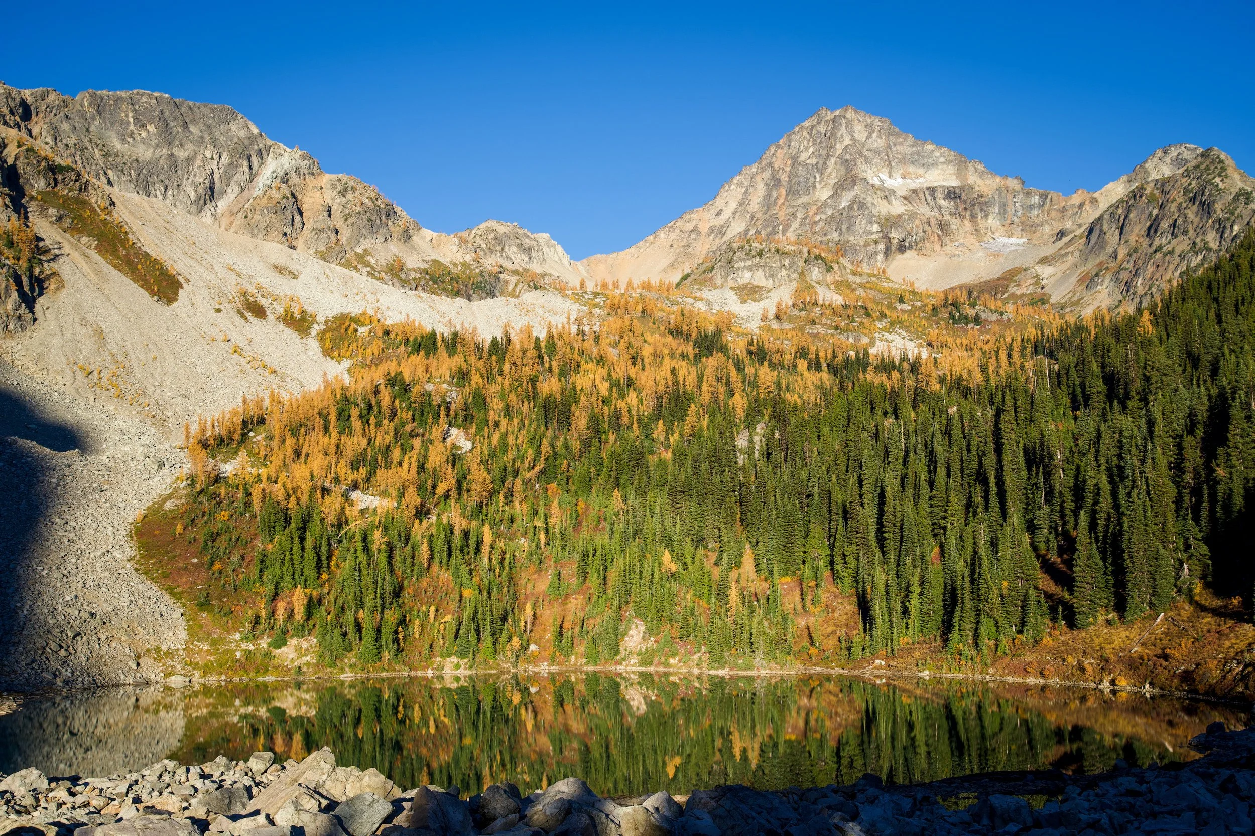

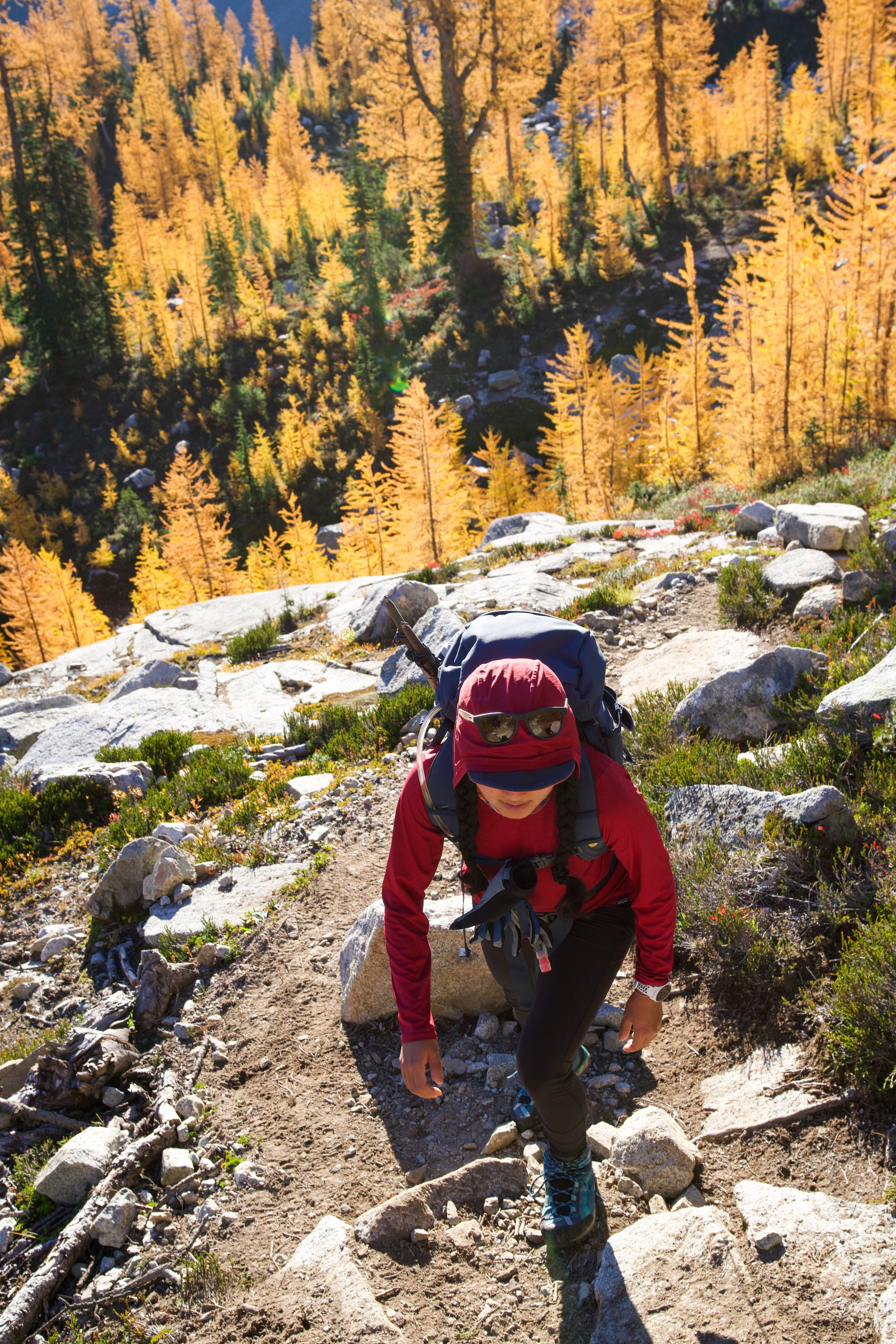
The trail up to Wing Lake was absolutely stunning. Walking through grove after grove of larch trees. The trail is a steady climbing for 1 mile before walking up to Wing Lake.


Wing Lake This is by far the prettiest alpine lake you’ll come across during your hike. It seemed to be very popular for camping.


We refilled water here before beginning the climb up to the ridge leading to Black Peak.
Walking up from Wing Lake, we stayed to the left of the creek. Eventually you’ll find yourself making your way up a very loose and steep scree field. If you’re not comfortable in this terrain, be very careful and use poles. If there are parties above you, I would probably go ahead and put a helmet on as well. This is where we saw lots of people struggle. Especially near the top of the ridge.

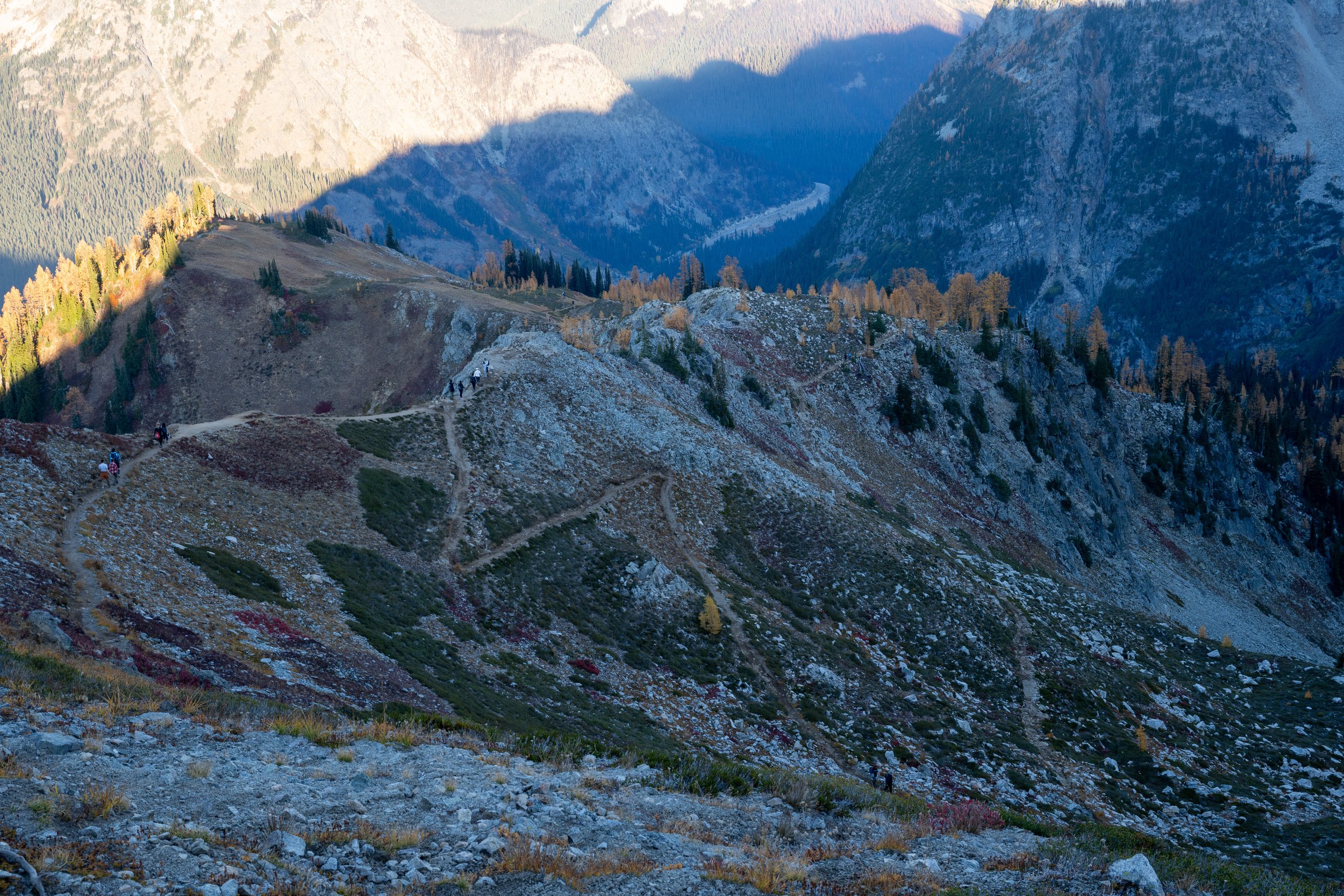
From the saddle you have great views looking East, South, and West of the Cascades.


We put our helmets on and began our push for the summit. This section is more loose scree with some class 2 scrambles thrown in occasionally. We found it much easier to stick closer to the large rocks and do ab it more scrambling than zig zagging up the loose scree. You’ll climb about 800 feet over the next .25 miles.

You’ll eventually reach a large area that is quite level. Here you have 2 choice. Scramble up the spine and climb along the top of this to the summit, or make your way along the base of the spine to the right where you will eventually find the class 4 scramble to the top. We walked right. The scramble isn’t anything crazy. It is quite exposed and if one did fall, there is nothing there to stop you from going for a ride. Use cation. If someone is not used to climbing, I would be extremely careful.
The summit was beautiful! With 360 degree views, you could see Mt. Baker, and Glacier Peak in the distance! Take a peak down the North side of Black Peak while you’re up there. It’s almost a sheer drop!


You’ll make your way back down the way you can. Going down was much easier to navigate as you can see routes from above much better. Please, please, please wear helmets while on steep scree like this. We had a couple below that did not have any kind of head protection on(Only one of them had a helmet and they left it strapped to their backpack for the entire climb), so we made sure to be extremely careful so we did not knock any rocks down towards them.

We made it down to Wing Lake fairly quickly. Enjoyed a quick bite and I took a dip in the FREEZING water.


The talus field was the hardest part on the way back because there is a little bit of a climb as you head back to Heather Pass. Unfortunately I donated my sunglasses to the talus field on the way back

Instead of going left and making our way back to the car, we decided to go right and do the rest of the Maple Pass Loop Trail. Holy cow it was busy! I think the people watching was better than the hike itself!
I think Maple Pass Loop is a perfect trail for a quick trail run. Not very technical, good climbs, and beautiful views. The Larches were definitely in peak color, so that explained the crowds of people.


We finished about 7pm in the dark and slept in the van at the parking lot. Loved every minute of this hike!