Your guide to hiking Hallasan Mountain on Jeju Island

For all the outdoor lovers and hikers out there, this one is for you! We noticed that there was little information in English on the details of hiking Hallasan Mountain on Jeju Island. We wanted to give you a comprehensive guide to hiking Hallasan.
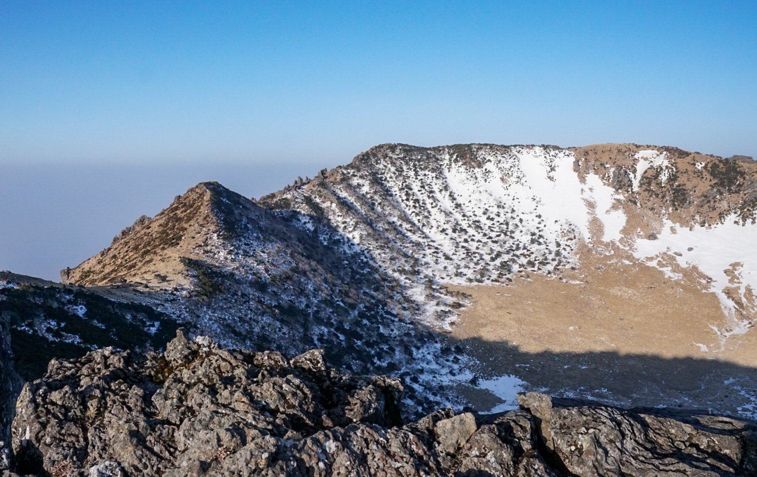
Hallasan Mountain is in the center of Jeju Island, and is the highest point in South Korea. It is considered one of the top three main mountains in South Korea.
*This guide has been made in March of 2023, details and bus routes may have changed, please let us know!
When to hike Hallasan?
The mountain is hiked all year long, If you want to see FEET of snow go in December - March.
Do you prefer flowers? More clear views? April - August
We hiked in early March and there was snow for over half the trail. We would recommend summer months to hike Hallasan, but if you are in Jeju island in the winter, go hike the mountain. It will be an adventure (just bring spikes)!

What route should you hike?
There are a total of 7 official routes on Hallasan mountain. Not all of them reach the summit and many of these routes are short and don’t require a reservation. But in order to get to the summit there are only two routes available: Seongpanak Trail and Gwaneumsa Trail. Also, you HAVE TO HAVE REGISTER to hike these two trails (we will explain this further). In order to hit both trails we recommend going up one trail and down the other. Both trails have such a difference in scenery it would be worthwhile to hike both! We went up the Seongpanak Trail and came down the Gwaneumsa Trail.
Seongpanak Trail: 4 hours 30 minutes - one way 9.6 km, less steep than the Gwaneumsa Trail but a longer distance. It is forested for most of the trail so many hikers favor going up this route. There is a 1000-person limit for going up this trail per day.

Gwaneumsa Trail: 5 hours - one way 8.7 km, steeper, many people will not finish the trail in time. This route is a little more intense and allows only 500 hikers per day to hike this trail.

Do you need to download a map?
We really didn’t need our map during the hike because the trail was marked so well and there are signs periodically (see photos above) to show where you are and how many kilometers you have left with the estimated time of the hike. We think you would only need a map to show you the different routes to get you back to your accommodation. There is only one bus that leads you to both of the trailheads, so as long as you know the timetable of when the bus arrives, it will be fairly straightforward.
How to apply for a hiking permit?
Go to https://visithalla.jeju.go.kr/main/main.do click English
Select the trail you will be hiking up either the Seongpanak Course or the Gwaneumsa Course. The other trails do not need a reservation to hike.
Choose the date of hiking and how many people that are hiking. You will have to go through a verification system in order to receive your QR code.
Once you are verified, you are able to choose the date of hike and the start time. There are 3 options to choose from 5:30~8:00, 8:01~10:00, and 10:01~12:30. (Times may vary based on what month you are hiking). Once you click a time frame it will show how many reservations they have left. 1000 people per day for Seongpanak Trail and 500 people per day for the Gwaneumsa Trail.
*The time frame you choose is the time frame you are allowed to enter the trailhead. No later or no earlier. We chose the earliest time, in order to beat the crowds and get to the summit with enough time to get down during daylight.
Finish filling out the form and click Reserve.
You should receive a confirmation number with a QR code to your email.
What time should I hike?
Please note that there is a strict time for entering and leaving the trail each season, and there is also a time for descending the summit. They have an intercom system that will make an announcement (In Korean). We recommend getting to the trailhead early in order to not be behind a ton of hikers and to give you plenty of time to enjoy the views. Especially during tourist season.
• Winter season (November - February) 06:00~12:00 Possible to enter the mountain, descend the summit by 13:30
• Spring/Autumn season (March, April, September, October) 05:30~12:30 Possible to enter the mountain, descend the summit by 14:00
• Summer season (May to August) 05:00~13:00 Possible to enter the mountain, and descend the summit by 14:30
How to get to the trail?
In order to get to the Seongpanak Trailhead:
There are only 78 parking spaces at the Seongpanak Trail Entrance (and in most cases, the parking spaces all get full before the trail opens), so if possible ride a taxi to the entrance or hop on a bus. If you want to be at the trailhead by 5:30am, a taxi will be your best bet. Taxi’s are very affordable in Korea, and our hotel made the call to arrange the time that it would pick us up.
From the city of Jeju, it takes about 40 minutes to get to the trailhead by taking bus number: 281 or 181. The bus times are listed on Jeju Island bus website.
From the city of Seogwipo take either bus number 182 or 281.
In order to get to the Gwaneumsa trailhead:
From the Jeju Bus Terminal to the trailhead it will take about 40 minutes. Take bus 281 to Stop at Korea Polytechnic University. Transfer to bus 475 to get to the Gwaneumsa Tambangro (Gwaneumsa Trail).
From the Seogwipo to the trailhead, it will take about 1 hour. Take bus 281 to Stop at Korea Polytechnic University. Transfer to bus 475 to get to the Gwaneumsa Tambangro (Gwaneumsa Trail).
Check bus times on the Jeju Bus Website: http://bus.jeju.go.kr/
We took a taxi to get to the Seongpanak Trailhead and took a bus down from the Gwaneumsa Trailhead.
The Taxi can be arranged at your hotel or on the Kakao taxi app. We reserved a taxi for 4:45 am to get us to the Seongpanak Trail. It costs us 25,000 KRW ($20 USD).
What is a certificate of summit and How do you get a certificate of summit?
One unique thing about this hike is if you hike to the summit, you can get on the Jeju Hallasan website and apply for a certificate of summit. You have to do it at the summit with your GPS on in order for them to certify you. It will ask you to upload a photo of yourself on the summit (do not keep your phone on airplane mode), and it will ask for your reservation number that was on your QR code email.
Once everything is filled out properly it will await approval from the office. Once you finish the trail, there will be a kiosk that prints out the certificate at the trailhead. Input your Reservation number, click on your name, pay by card, and it will print out a Summit Certificate! (Cost us about $2 US)

Hallasan does take a little bit of planning due to the reservation system and time restrictions, but it is definitely one of our favorite things we did on Jeju island! The scenery is absolutely stunning from the summit!